Evening Drone Pic

rusty6

Well-known Member
Out for some sunset shots this evening with the drone. All day was too windy to spray, rain shower stopped me picking rocks or cutting lawn so I sort of had Sunday off for a change. Except for the morning spent chain sawing dead trees off the fence lines.
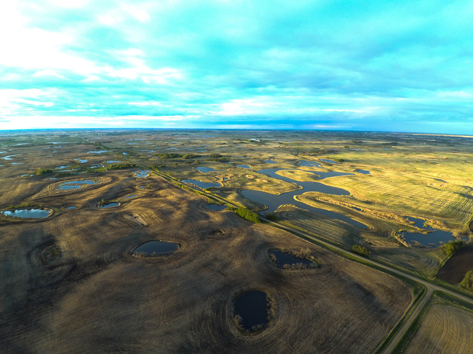
This view at the end of my driveway shows some of the semi-permanent bodies of water that are typical here in "pothole country".
a161269.jpg
 
(quoted from post at 21:00:06 05/28/17) Looks like you have Minnesota beat...."land of ten thousand lakes".

Eh, we've got the lakes here as well, but have enough trees that hide them better. That pic makes for some beautiful aerial scenery, but I sure wouldn't want all that openness in the Winter winds!
 
The county I live in is called Kawartha Lakes , pretty sure we don't have as many lakes as you have ponds . I will just bet there were years when at least half of those ponds were seed into crop. Or at the very least dry enough to make slew hay off of them . Great for ducks and Moose .
 
(quoted from post at 04:09:52 05/29/17) I will just bet there were years when at least half of those ponds were seed into crop. Or at the very least dry enough to make slew hay off of them . Great for ducks and Moose .

Absolutely right. In moderate dry years the sloughs would dry to the point my dad could cut a lot of slough hay for cattle feed. In 1988 you could not find water in any of those fields. Hard to believe now when there are several feet of water in most of them. And many of those sloughs used to be surrounded by a ring of trees, or at least willows. Rising water levels killed the trees. No fish to be found. Just muskrats and beavers.
Altitude of the photo might have been about 800 feet.
 
A Moraine is the, most often, southernmost point where the glaciers reached. The leading edge of the glacier pushed rock and debris into a
Moraine in front of the glacier which was left when the glacier melted.
The Kettle Moraine is in southern Wisconsin.It is also a glacial boundary area but includes wet spots or Kettles where chunks of the glacier
were calved off and buried. When the glacier retreated, these chunks melted and created low, wet spots referred to as Kettles.
So endith your geography lesson for today...lol!
 
(quoted from post at 07:01:55 05/29/17) A Moraine is the, most often, southernmost point where the glaciers reached. The leading edge of the glacier pushed rock and debris into a
Moraine.!
Sounds like what we have here. The little creeks that drain (some of) the water away have gravel deposits all along them. I've got a couple on my quarter across the road that I have hauled a lot of gravel , sand and rocks out of .
 

We sell tractor parts! We have the parts you need to repair your tractor - the right parts. Our low prices and years of research make us your best choice when you need parts. Shop Online Today.

Back
Top